- Date of Incident
- 01 Apr 2000 – 01 Apr 2019
- Location
- Earth
- Publication Date
- 05 Jul 2019
- Commissioned By
- Self-Initiated
- Additional Funding
- None
- Collaborators
- FIBGAR - Fundación Internacional Baltasar Garzón
- Methodologies
- Remote Sensing
- Forums
- —
- Exhibitions
- Slow Boil
The relation between warfare and climate change is identifiable along two thresholds – the thresholds of the desert and of the rainforest. These are ‘political equators’ that circle the planet. Along them, agrarian economies of fields and orchards push against areas considered to be ‘no man’s land’. While the threshold of the desert is a limit defined by water scarcity, the shifting threshold of the tropics results from overabundant water and vegetation. Unlike sovereign borders, created by states and fought over by militaries, these frontiers are not demarcated by fences and walls, but rather by a seam between meteorological conditions.
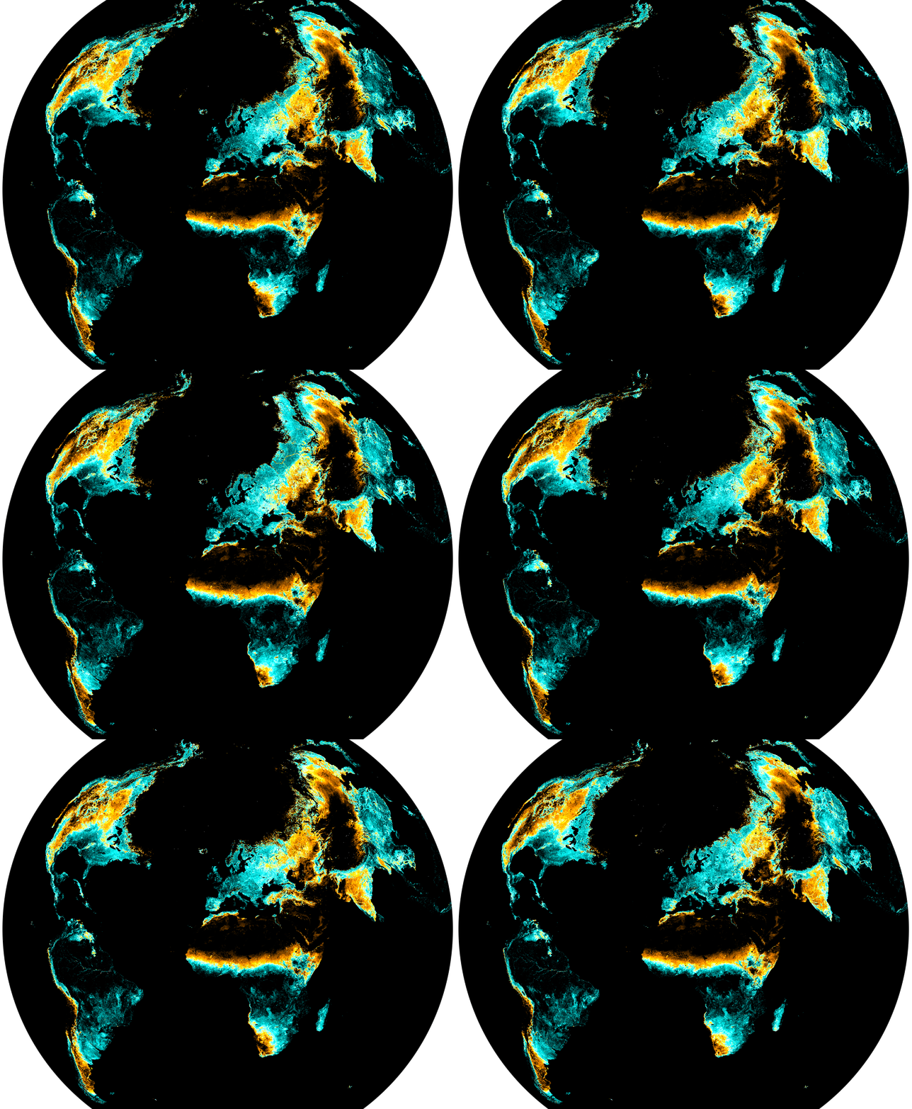
Single year analysis
In this study, we have used Normalized difference Vegetation Index (NDVI) analysis to map the shifting thresholds of forest and desert throughout the course of a single year, from April 2018 to April 2019.
The shifts are vast, sometimes traversing entire countries. These shifts could correspond to seasonal variations.
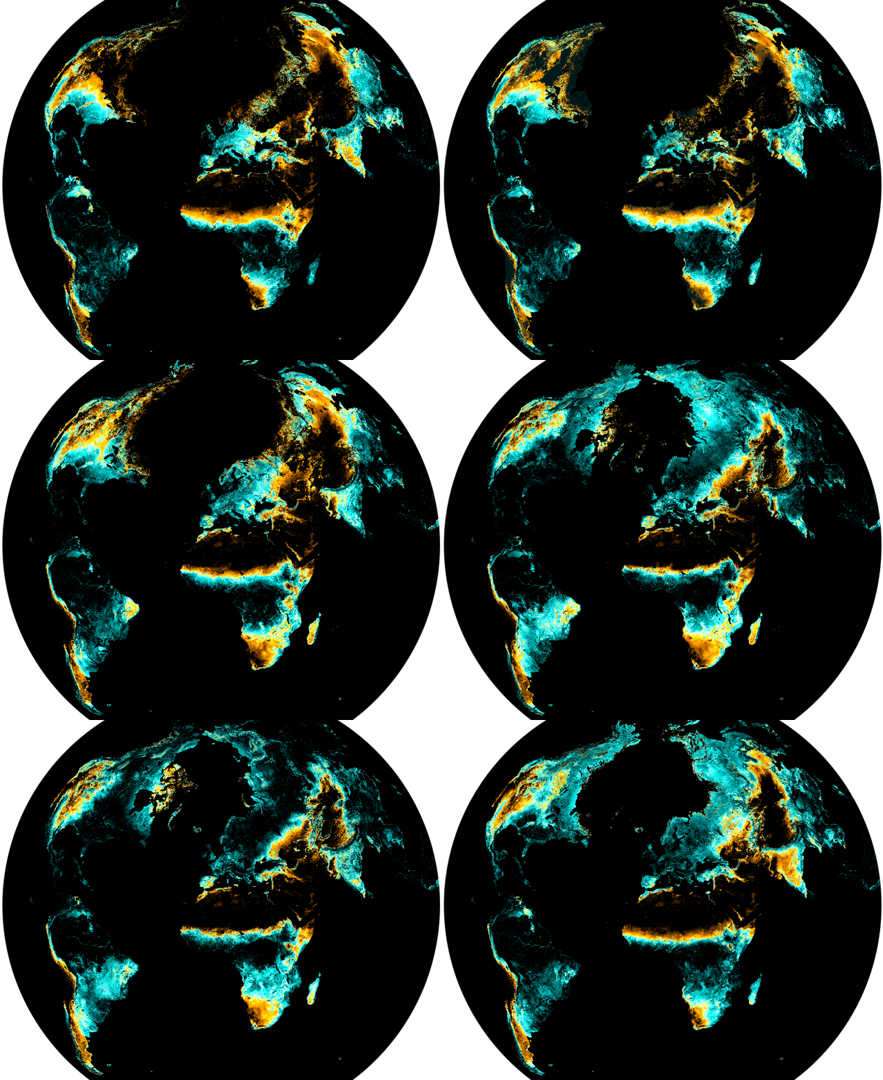
Ten year analysis
We used the same remote sensing technique to map these shifting thresholds specifically for the month of April in each of the past ten years.
The study shows that these thresholds are far from static, even at the same time of every year.