

- Date of Incident
- 27 Mar 2011 – 10 Apr 2011
- Location
- Mediterranean Sea
- Publication Date
- 11 Apr 2012
- Commissioned By
- Self-Initiated
- Additional Funding
- HKW - Haus der Kulturen der Welt, European Research Council (ERC)
- Collaborators
- SITU Research, Groupe d'information et de soutien des immigrés (GISTI), Migreurop, International Federation for Human Rights (FIDH), Coordination et initiatives pour réfugiés et étrangers (CIRÉ), Ligue des droits de l'Homme (LDH), Human Rights Watch
- Methodologies
- Remote Sensing, Fluid Dynamics
- Forums
- Legal proceedings in France, Belgium, Spain and Italy
- Exhibitions
- Counter Investigations, Forensic Architecture: Towards an Investigative Aesthetics, Forensic Architecture: Hacia una Estética Investigativa, In the Vestibule with Forensic Architecture, Transit, Forensis, Blaming the Rescuers, Another Spring, From Ear to Ear to Eye, Frontieres, The Oceanic, Neotopia: Data and Humanity, Liquid Violence at Kunstenfestivaldesarts 2019, We Are Still Alive, Like Hydrogen and Oxygen, Liquid Violence at Manifesta 12, Sink Without Trace, Disappearance at Sea – Mare Nostrum, Homeless Souls, Insecurities: Tracing displacement and shelter, It is Obvious from the Map at the 2016 Istanbul Design Biennial, ASYLUM, As Rights Go By, Making Use: Life in postartistic times, If All Relations Were to Reach Equilibrium, Then This Building Would Dissolve, The Restless Earth (La Terra Inquieta) at La Triennale di Milano, How The Light Gets In, Big Bang Data at Somerset House, Tense Present at KIBLA, Liquid Traces at We Are Ocean, Liquid Violence at Short Festival, No Access
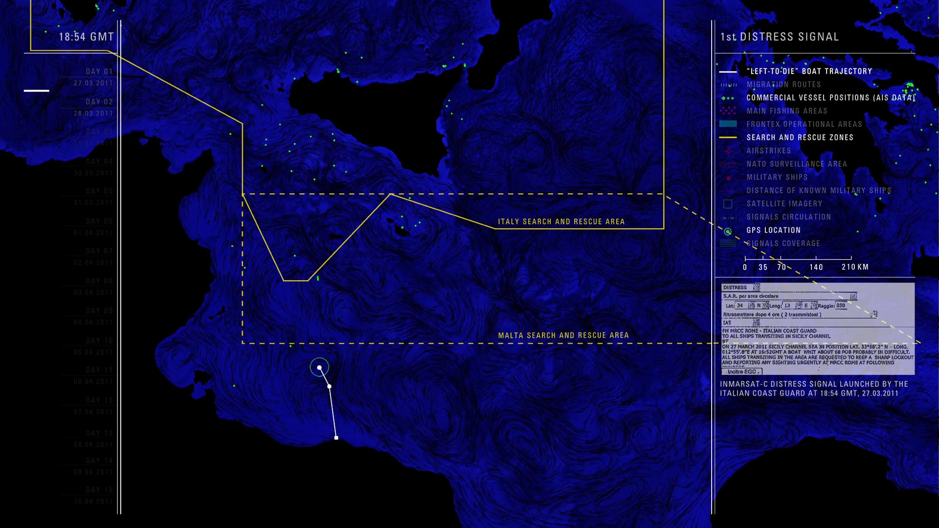
In March 2011, 72 passengers left the Libyan coast heading in the direction of Italy on board a small rubber boat at the time of NATO’s military intervention in Libya. Despite several distress signals relaying their location, as well as repeated interactions with at least one military helicopter and a military ship, they were left to drift for 14 days. As a result of the inaction of all state actors involved, only nine of the passengers survived. By combining their testimonies with wind and sea-current data as well as satellite imagery, Forensic Oceanography reconstructed the liquid traces of this event, producing a report that served as the basis of several legal complaints.

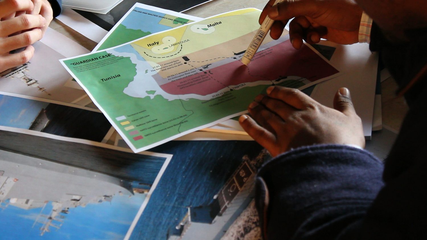
In our interview with Dan Haile Gebre, one of the survivors, we tried to depart from formats of witnessing normally associated with humanitarian organizations.
Rather than placing the emphasis on the subjective dimension of his experience, we used various memory aids—such as photographs of naval and aerial assets that were present in the area at the time of the events—to assist him in remembering details that could support the reconstruction of the event, and the identification of the various vessels and aircraft encountered by the vessel while at sea.
Summary of Key Events
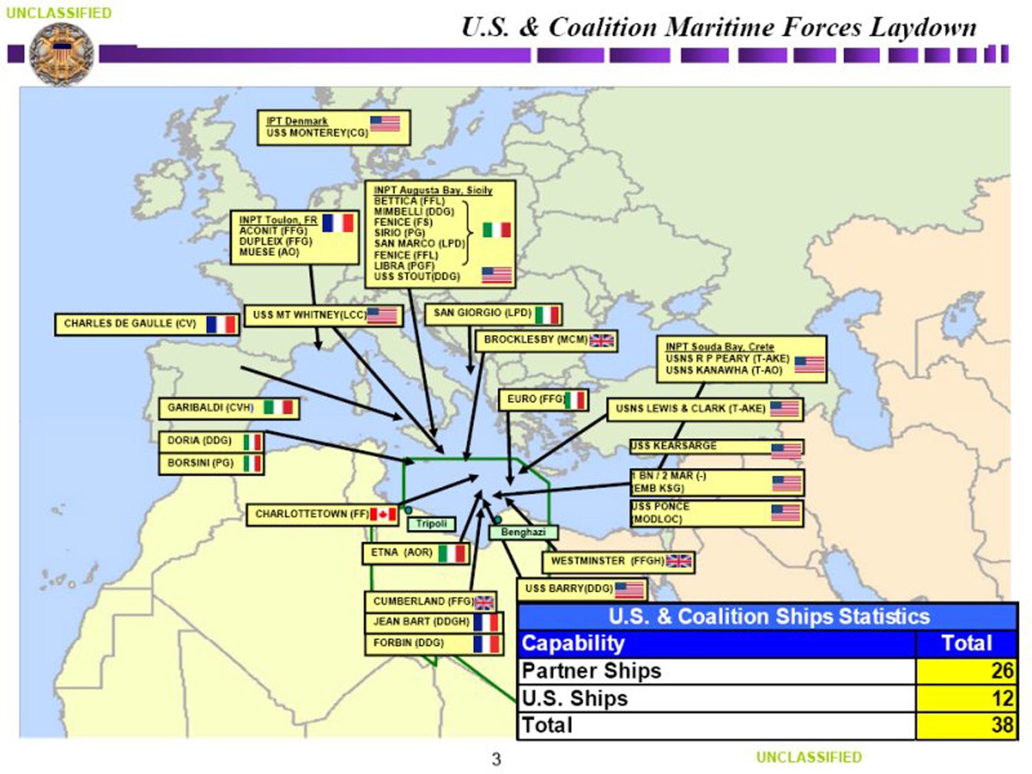
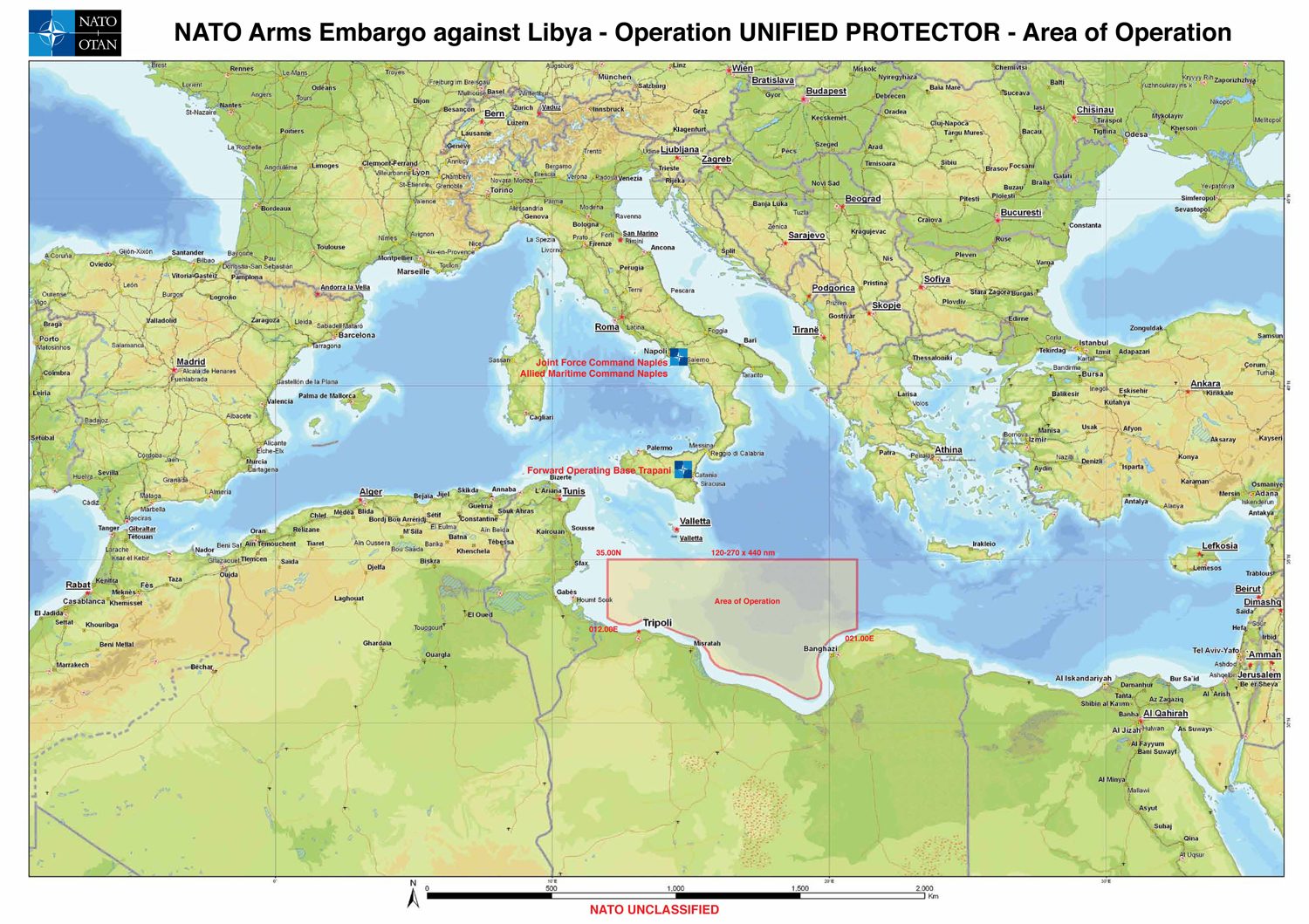
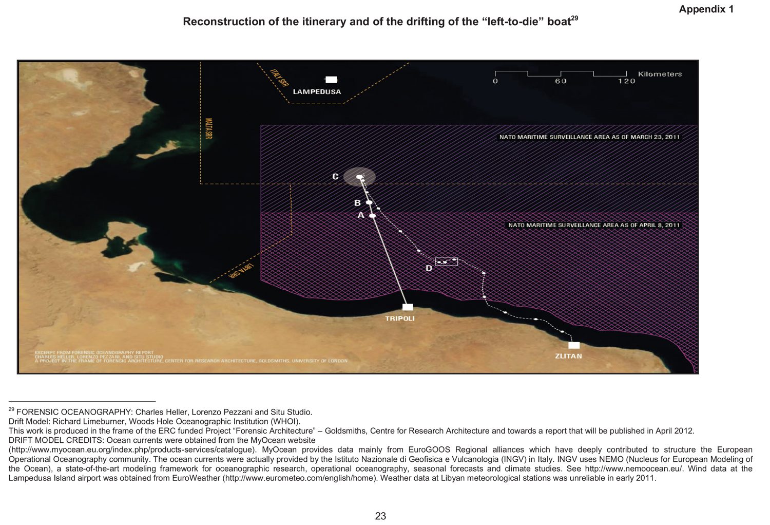
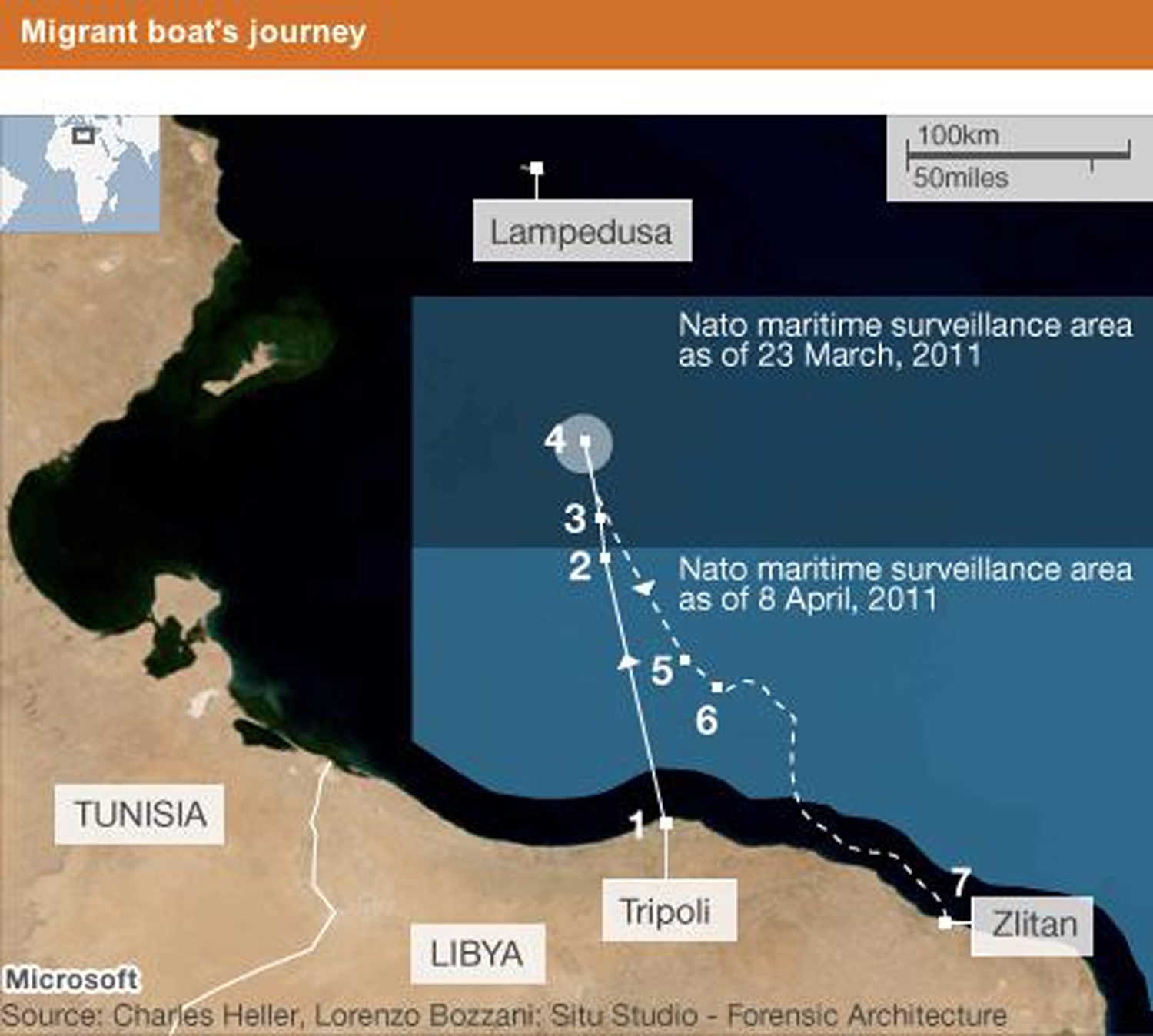
1. The vessel left the port of Tripoli between midnight and 2:00am (all times GMT) on 27 March 2011 with seventy-two migrants on board. At that time, as part of the military operations in Libya, NATO was enforcing an arms embargo in the central Mediterranean. As a result, during that period it was the most highly surveilled area of sea in the world.
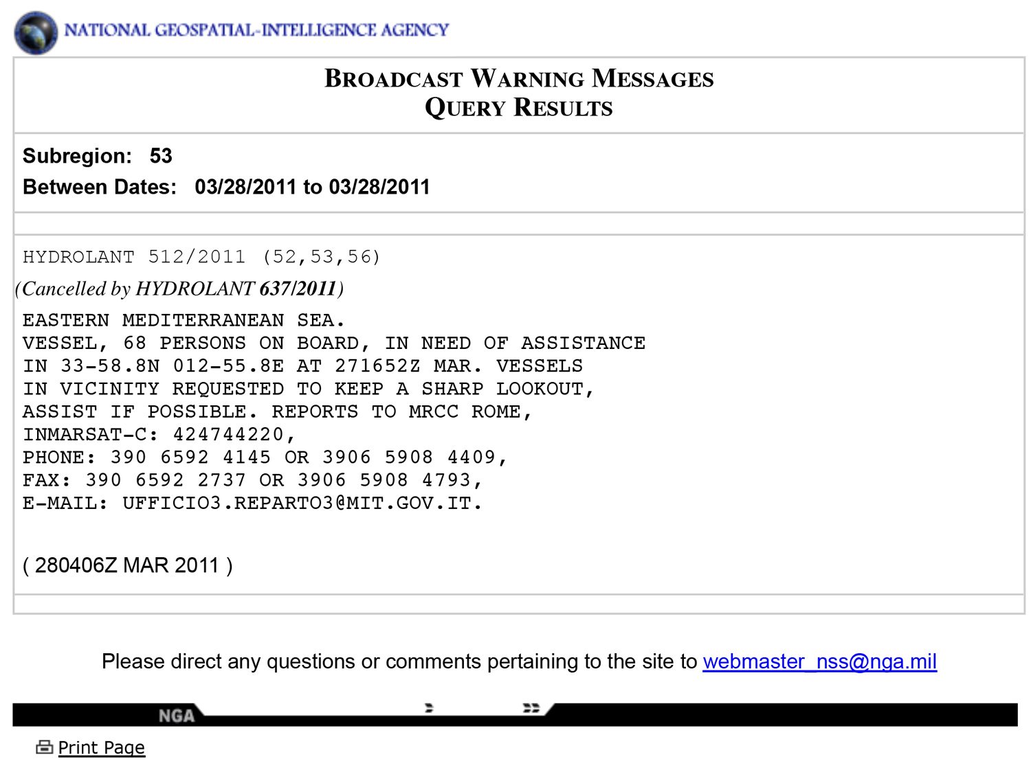
2. At 2:55pm on 27 March, the boat was spotted by a French aircraft that transmitted its coordinates (point A on the map to the right) to the international Maritime Rescue Coordination Centre (MRCC).
3. After proceeding toward the Italian island of Lampedusa for between fifteen and eighteen hours, the migrants placed a distress call by satellite phone. The vessel’s GPS location was determined at 4:52pm on 27 March 2011 (point B) by the satellite phone provider Thuraya. Shortly thereafter, the MRCC in Rome signaled the boat’s distress and position to all vessels in the area. It also alerted Malta’s MRCC, and NATO HQ Allied Command, in Naples.
4. The migrants’ vessel continued its course for approximately two hours before being flown over by a helicopter. The satellite phone fell into the water shortly after this sighting, so the last signal detected by Thuraya at 7:08pm on 27 March (point C) likely gives us the approximate location of the helicopter sighting. The migrants approached several fishing boats in this area for help, but were ignored. They were also visited a second time by a military helicopter. It dropped some biscuits and water onto the boat before leaving. Between midnight and 1:00am, the vessel resumed its course towards Lampedusa.
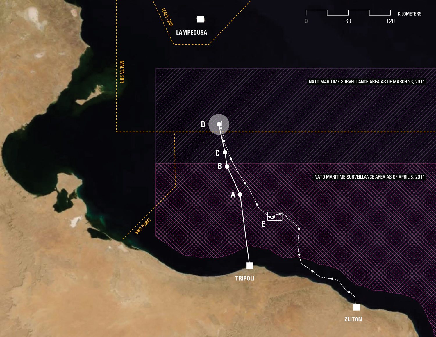
5. At approximately 7:00am on 28 March, after having probably entered the Maltese Search and Rescue (SAR) area, the vessel ran of fuel and began to drift SSW (point D).
6. The boat drifted SSW for seven to eight days before it encountered a military ship between 3 and 5 April (point E). Despite approaching them in circles and witnessing the distress of the passengers, the ship left without assisting them.
7. The boat continued to drift until April 10 when it landed southeast of Tripoli at Zlitan. Upon landing, eleven migrants were still alive; two died shortly thereafter.
Alerting the Coastguard
Information about the migrants’ situation circulated through a complex assemblage of people, electromagnetic signals and hardware.
The initial call for help was made by the migrants themselves via a satellite phone, fifteen to eighteen hours after they had departed from Tripoli.
The passengers called an Eritrean priest based in Rome, Father Zerai, who has received hundreds of distress calls from the Mediterranean over recent years. He informed the Italian coastguard of the situation.
The coastguard, after obtaining the GPS location of the boat from the satellite phone provider Thuraya, informed their Maltese counterparts and NATO’s Maritime HQ in Naples, as well as sending out two distress signals to all nearby ships.
As such, all vessels in the area—civilian and military—should have been aware of the location of the vessel, and its perilous situation.
Drift
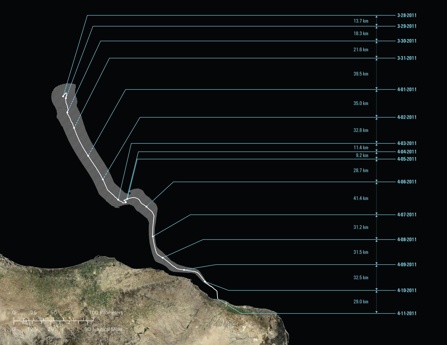
According to the survivors, in the early hours of 28 March 2011 their vessel ran of fuel and began to drift aimlessly for the remainder of its trajectory. Where exactly did the boat begin to drift, and what course did it follow?
These are questions that we addressed in collaboration with oceanographer Richard Limeburner (Woods Hole Oceanographic Institute). With his help, we were able to reconstruct the trajectory of the boat during its fourteen days of deadly drift, by analysing winds and currents.
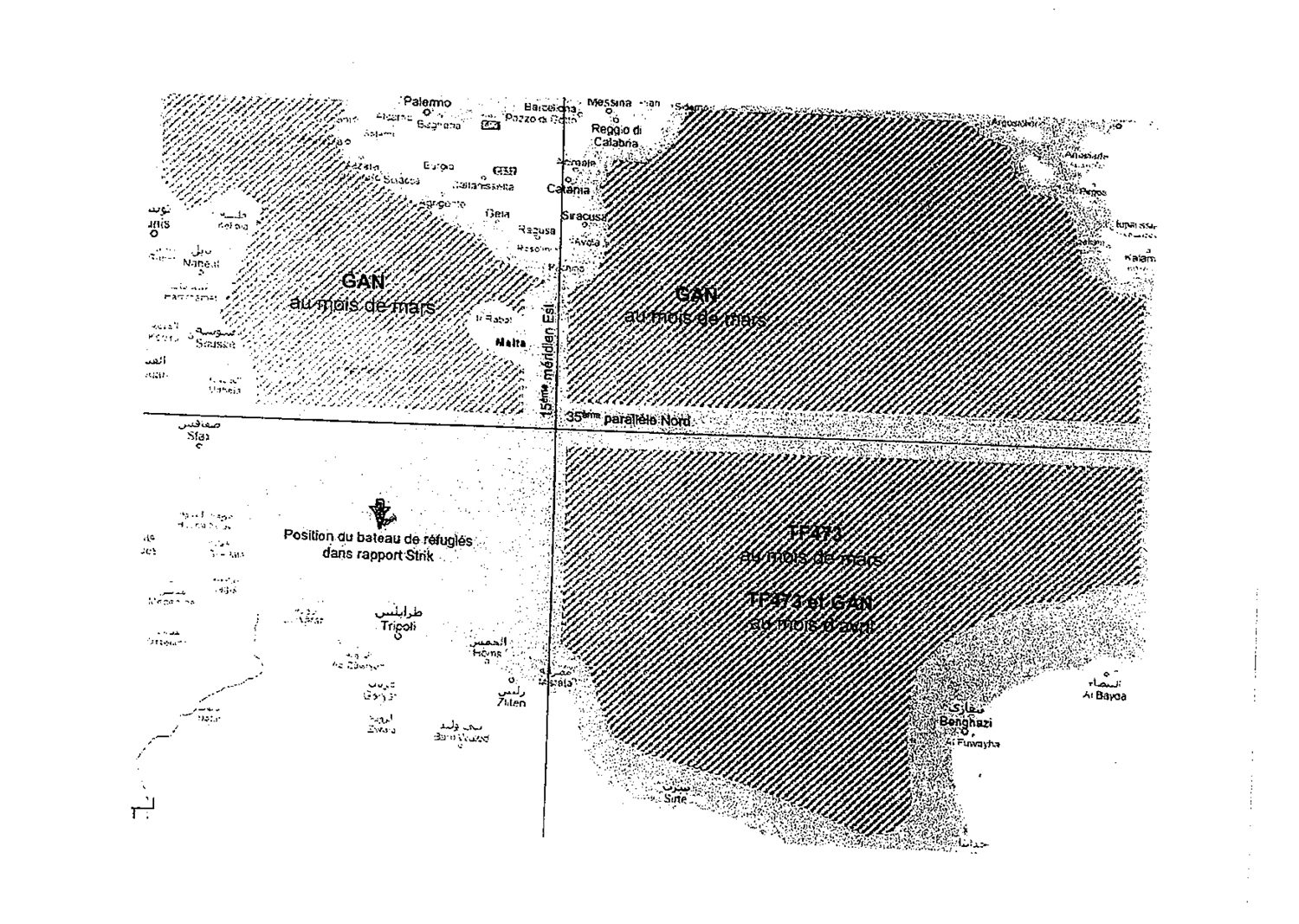
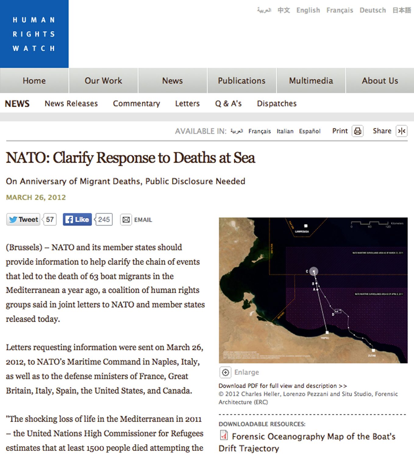
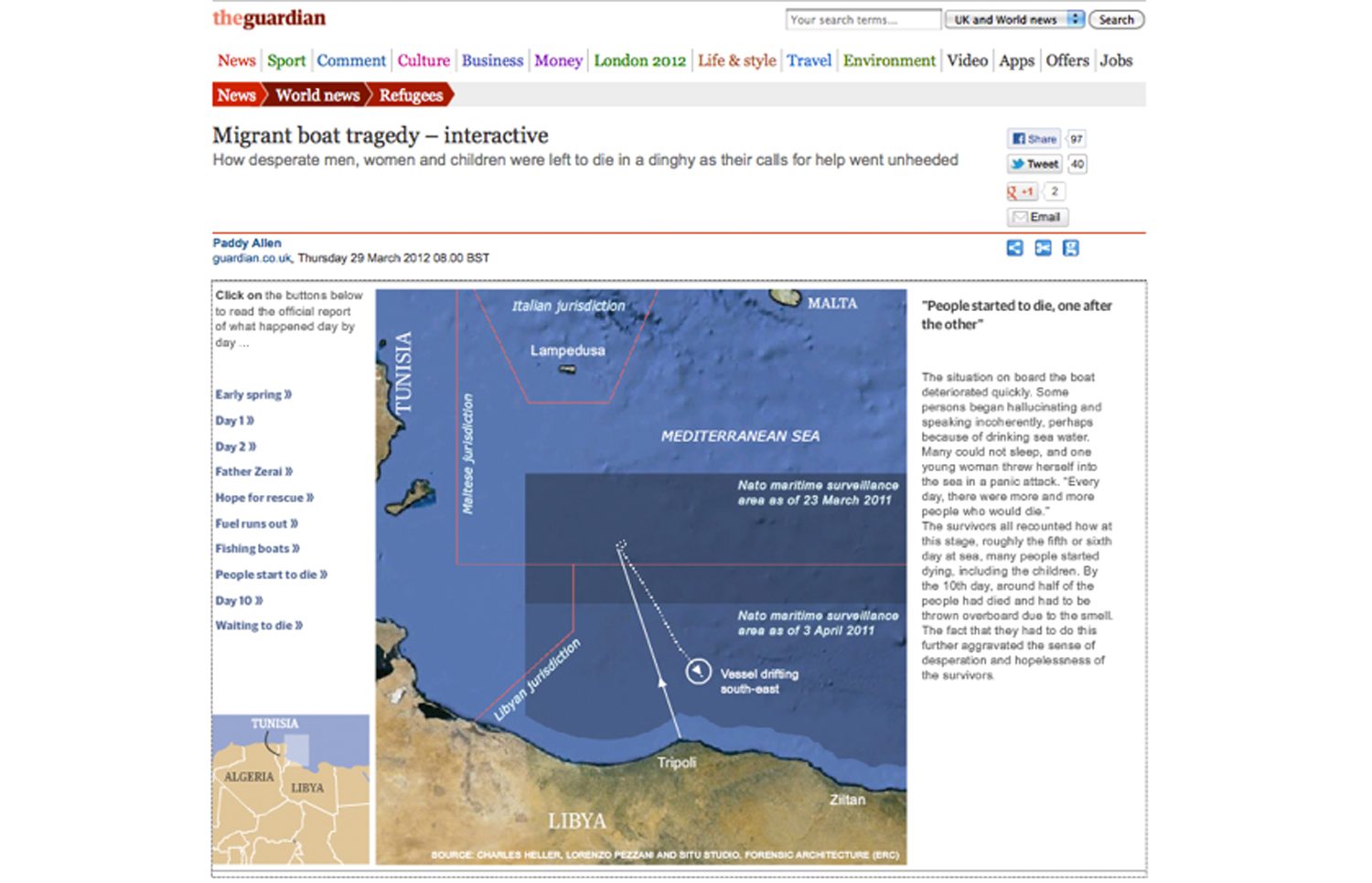
According to that reconstruction, the vessel briefly entered the Maltese search and rescue zone, though for the majority of its trajectory it remained within the NATO maritime surveillance area.
Use of satellite imagery
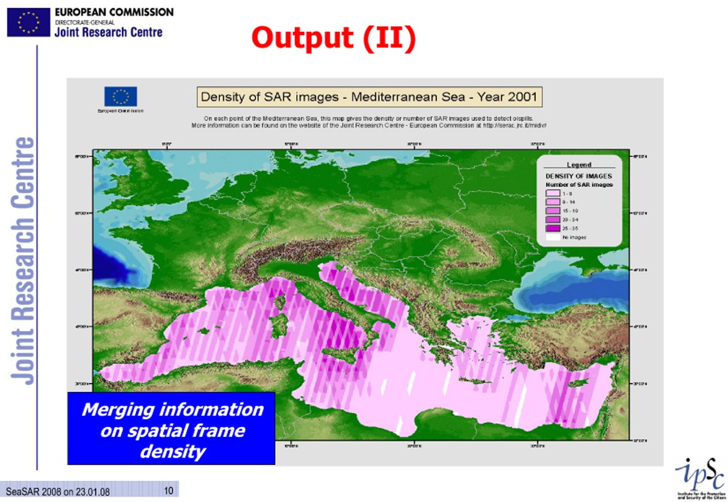
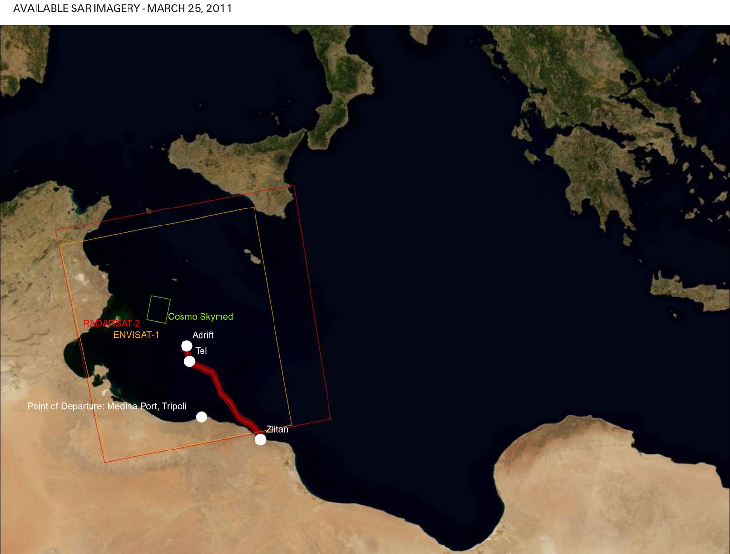
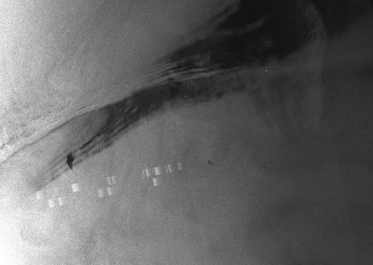
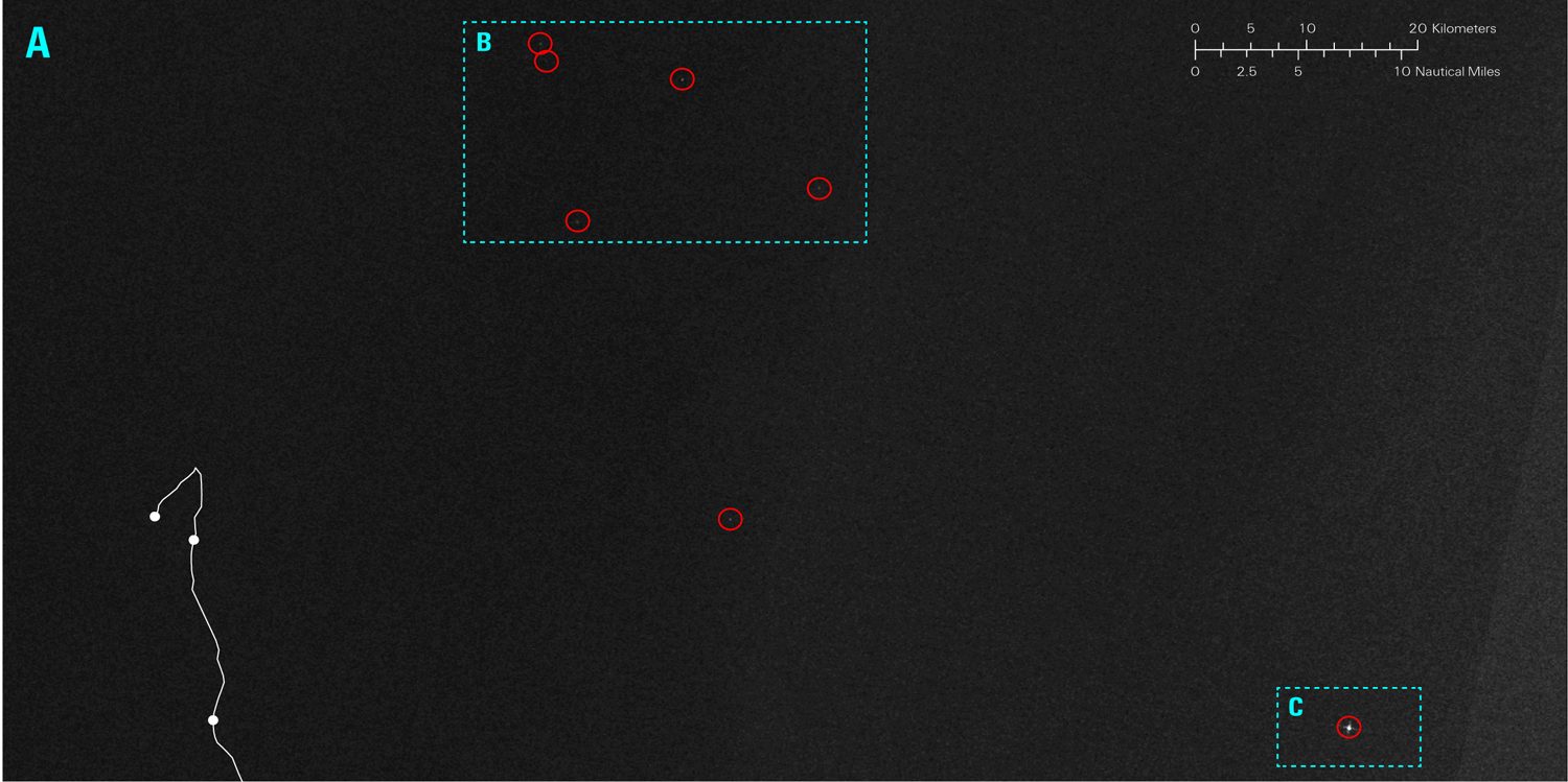
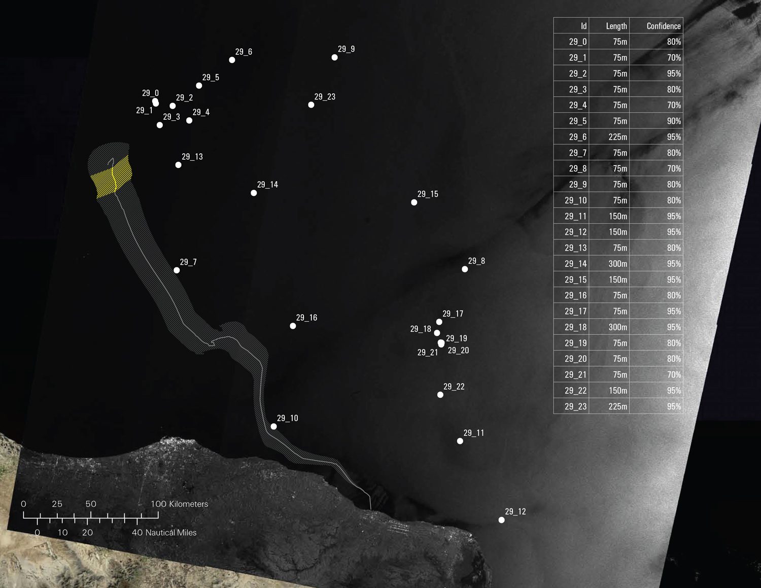
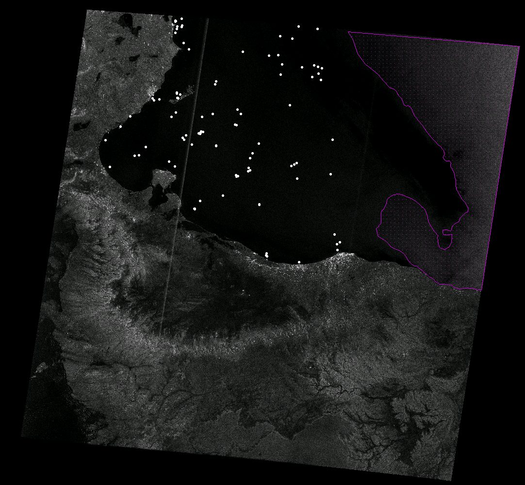
Satellite imagery confirmed the presence of a high number of ships in close proximity to the drifting vessel. Synthetic Aperture Radar (SAR) satellite imagery is routinely collected over the Mediterranean Sea for various purposes, including the policing of illegalised migration.
Using these media to document the crime of non-assistance of people in distress at sea thus involved a strategic repurposing of images and surveillance technologies. In this we exercised a ‘disobedient gaze’, one that refuses to disclose clandestine migration but seeks to expose instead the violence of Europe’s border regime.
Sensing technologies
Optical and SAR satellites are only two among a vast array of sensing technologies—thermal cameras, sea-, air- and land-borne radars, and vessel-tracking technologies—that scan the surface of the sea, turning certain physical conditions into digital data according to specific protocols, and determining conditions of visibility for certain events, objects, or people.
The constant emission and capture of different electromagnetic waves operated by these technologies gives a new material meaning to Fernand Braudel’s metaphor of the Mediterranean as an ‘electromagnetic field’ in terms of its relation to the wider world. These sensing technologies do not simply create a new representation of the sea, but rather constitute a new sea altogether, one that is simultaneously composed of matter and media.
While optical satellite imagery forms images of the Earth’s surface by detecting the solar radiation reflected from targets on the ground, SAR imaging uses an antenna to transmit microwave pulses towards the Earth’s surface. The microwave energy scattered back to the satellite is measured, and an image is formed by utilising the time delay of the returning signals.
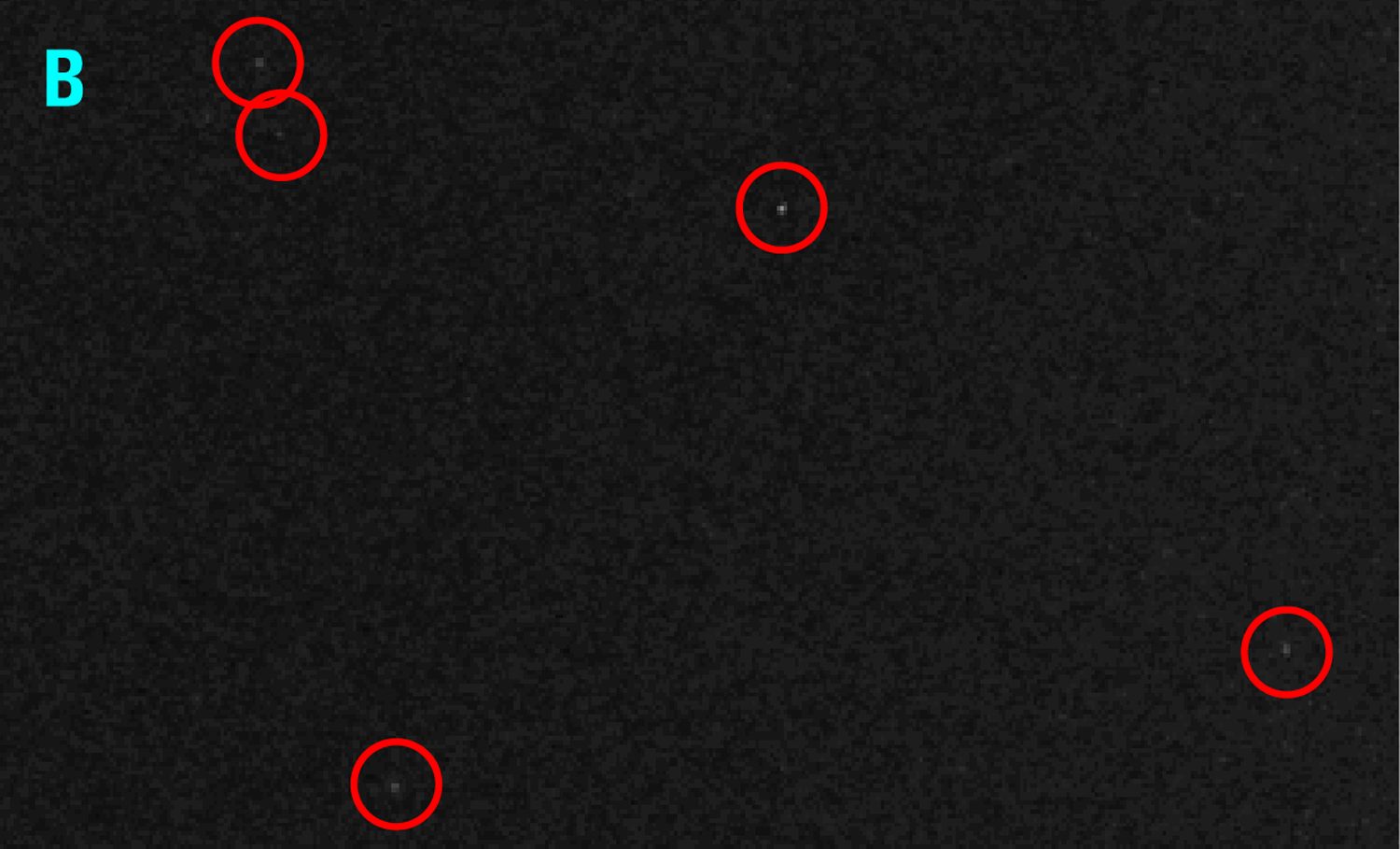
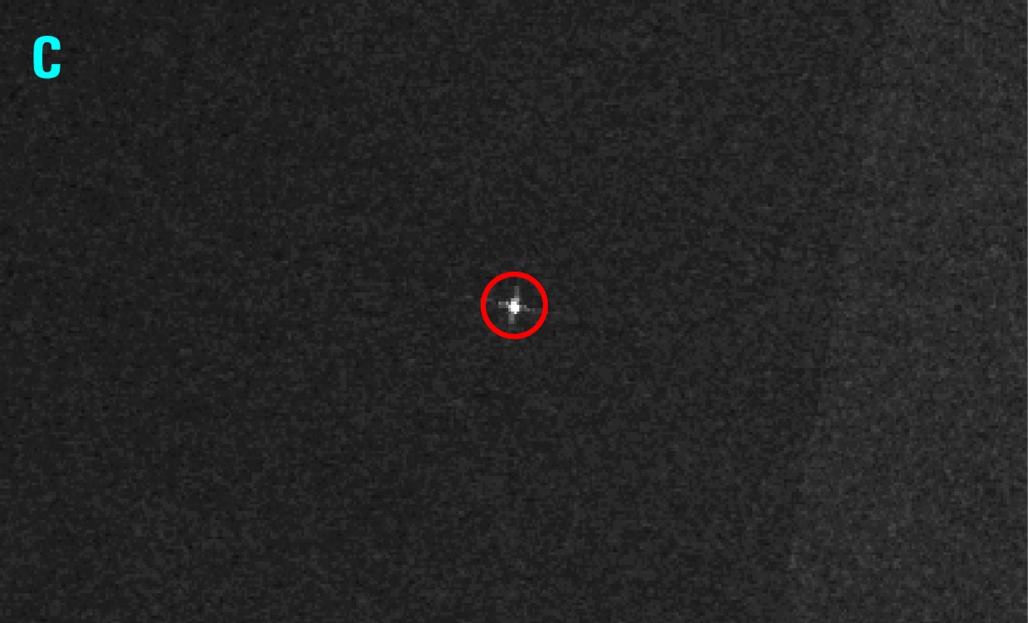
Calm sea surfaces appear dark in SAR images, whereas ships reflect most of the radar energy back to the sensor, appearing as bright pixels against a uniform background.
Analysing signals
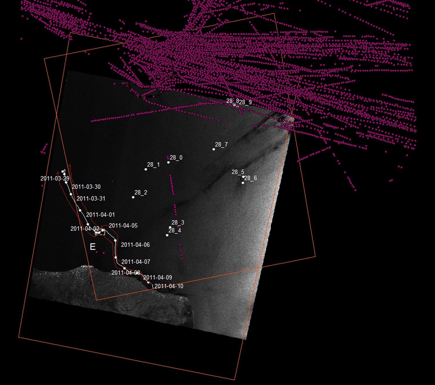
AIS (Automatic Identification System) is a ship-borne transponder system that sends out a signal to coastal or satellite receivers, providing live information regarding the position of all registered vessels. The system is mandatory for large commercial ships, but not for warships and other certain categories of vessel.
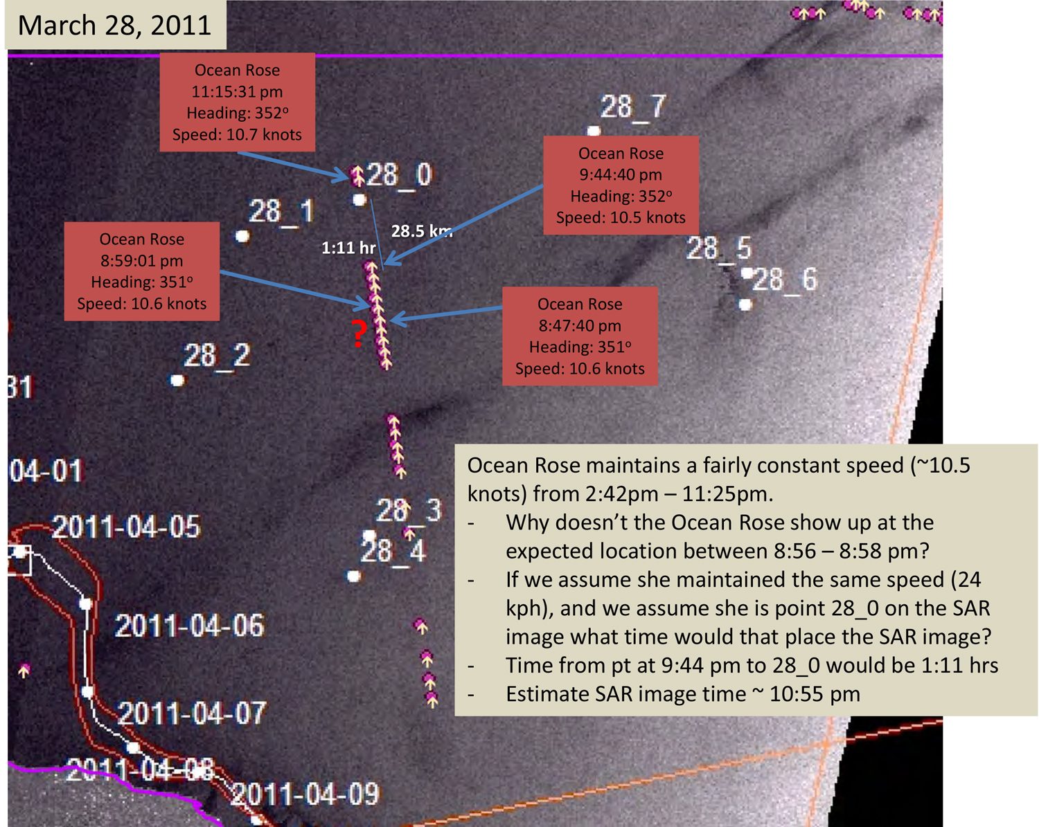
Forensic Oceanography analysed AIS data in conjunction with SAR imagery in the attempt to ‘negatively’ identify military ships in the vicinity of the migrants’ vessel, by determining which large vessels were not accounted for in the AIS data.
Inconsistency in the dataset for that period and area—probably due to an absence of recorded data along the Libyan coast—ultimately meant that the AIS data could not be matched satisfactorily with satellite imagery targets. Nevertheless, the data provided a remarkable snapshot of commercial maritime traffic though the Strait of Sicily.
Search and Rescue conventions
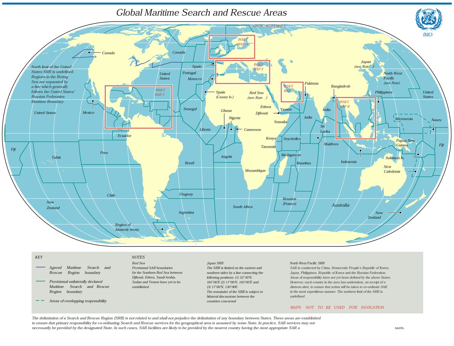
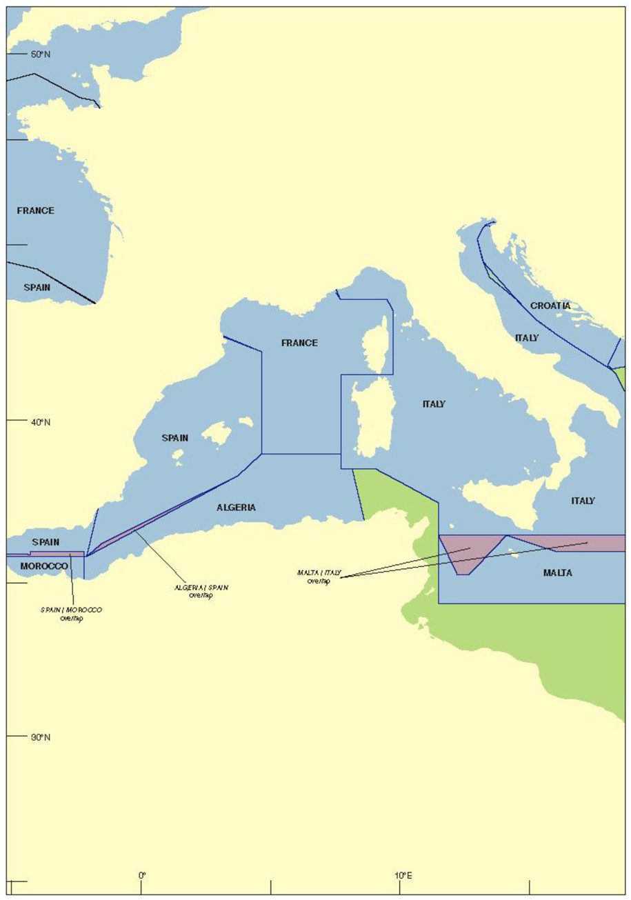
The 1979 International Convention on Maritime Search and Rescue (S&R) divided the world’s oceans into search and rescue areas. The countries overseeing each area are responsible for assisting people in distress at sea.
However, the elastic nature of international law has often been strategically mobilized by coastal states to avoid engaging in rescue missions. In the central Mediterranean, in particular, the delimitation of S&R zones has a long and conflict-ridden history. Tunisia and Libya have refrained from defining the boundaries of their S&R zones, while Italy and Malta have overlapping S&R zones and are signatories to different versions of the S&R convention—a situation which has led to repeated stand-offs and tragedies, and certainly contributed to the events of the ‘left-to-die boat’ case.
Legal Cases
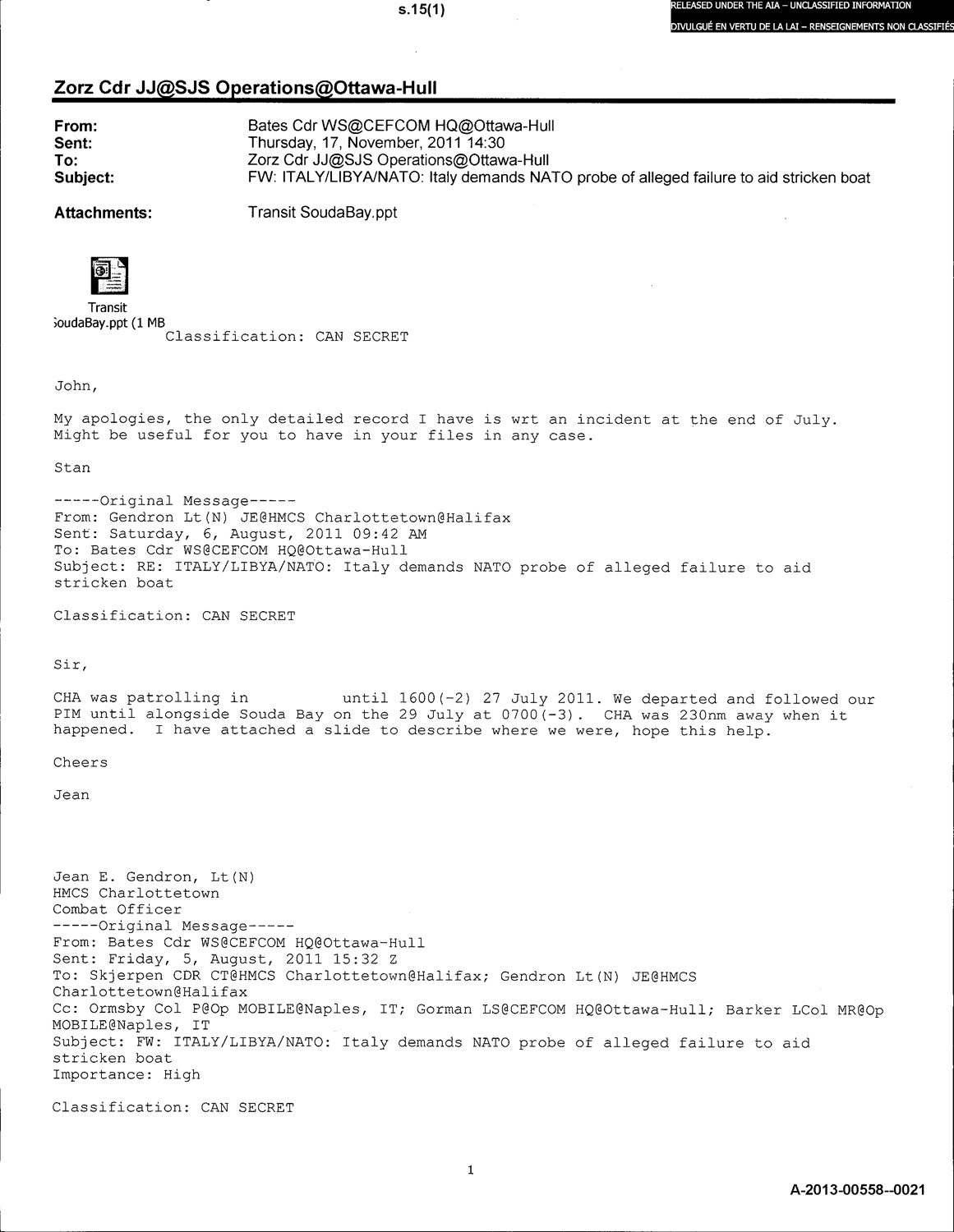
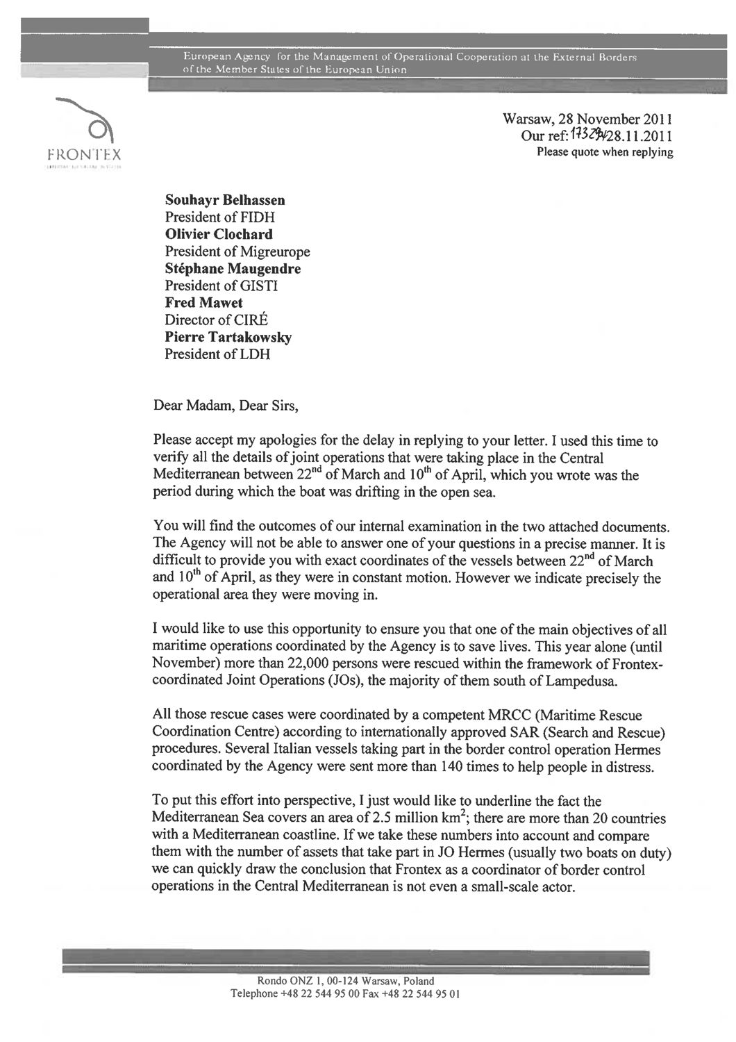
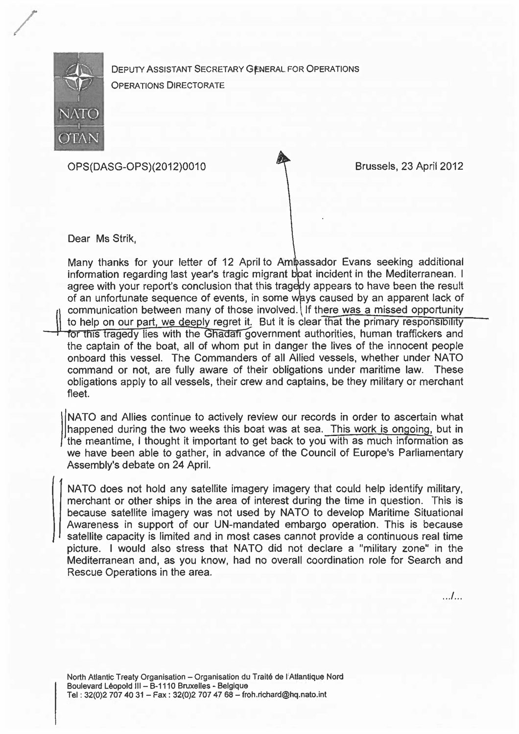
Our report has been presented in the context of multiple legal cases concerning non-assistance at sea which have emerged from the efforts of a coalition of European NGOs.
The coalition includes: The Aire Centre, Agenzia Habeshia, Associazione Ricreativa e Culturale Italiana (ARCI), Associazione per gli Studi Giuridici sull’Immigrazione (ASGI), Boats4People, Canadian Centre for International Justice, Coordination et initiatives pour réfugiés et immigrés (Ciré), Fédération internationale des ligues des droits de l’Homme (FIDH), Groupe d’information et de soutien des immigrés (GISTI), Ligue belge des droits de l’Homme (LDH-Belgique), Ligue française des droits de l’Homme (LDH-France), Migreurop, Progress Lawyers Network, Réseau euro-méditerranéen des droits de l’Homme (REMDH), and Unione Forense per la Tutela dei Diritti Umani (UFTDU).
International civil society response
Cases have been filed in France, Italy, Belgium, and Spain, while Freedom of Information requests have been submitted in Canada, the US, and the U.K. These initiatives, as well as an investigation by the Council of Europe and by several journalists, have forced states and militaries to release further data about the event.
The facts of the case as present by FO’s report have never been contested, but what official information has been provided in response remains vague and incomplete, and we are still unable to determine legal responsibility for the deaths.
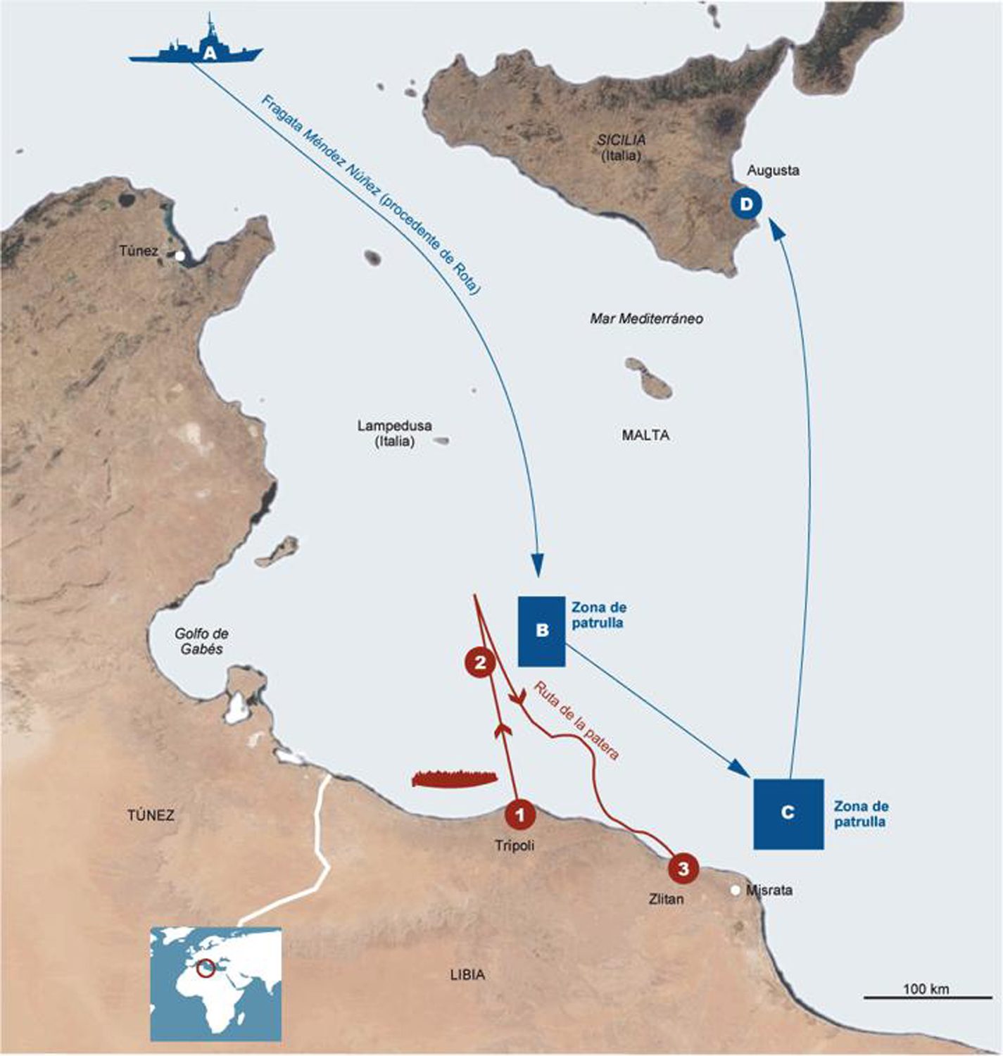
The maps produced by FO in relation to this case have been circulated widely in the international press, in activist circles, and in legal and political documents. Modified, cropped, deformed, misspelled, and redrawn, they have nevertheless spurred discussion around this case and spread that discussion across legal, political and media forums.
Methodology
Satellite imagery
Satellite imagery was crucial in confirming the presence of a high number of ships in close proximity to the drifting migrants’ boat. Synthetic Aperture Radar (SAR) satellite imagery is routinely collected over the Mediterranean Sea for various purposes, including the policing of illegalised migration.
Using these media to document the crime of non-assistance of people in distress at sea was thus a strategic repurposing of these images and the use of surveillance technologies ‘against the grain’. In this we exercised a ‘disobedient gaze’, one that refuses to disclose clandestine migration but seeks to unveil instead the violence of the border regime.
While optical satellite imagery forms images of the Earth’s surface by detecting the solar radiation reflected from targets on the ground, SAR imaging uses an antenna to transmit microwave pulses towards the Earth’s surface. The microwave energy scattered back to the spacecraft is measured, and an image is formed by utilising the time delay of the signals as they return. Calm sea surfaces appear dark in SAR images, whereas ships reflect most of the radar energy back to the sensor, appearing as bright pixels against a uniform background.
Oceanography
Richard Limeburner of the Woods Hole Oceanographic Institute assisted FO in employing winds and currents to reconstruct the trajectory of the boat during its fourteen days of deadly drift. While we conclude that the vessel briefly entered the Maltese search and rescue zone, for the majority of its trajectory it remained drifting slowly within the NATO maritime surveillance area.
Sensing technologies
A vast array of sensing technologies—including thermal cameras, sea-, air- and land-borne radars, vessel-tracking technologies—that scan and analyse the surface of the sea, turning physical conditions into digital data according to specific protocols, and determining the conditions of visibility of events, objects, or people.
The constant emission and capture by these technologies of different electromagnetic waves confers a new material meaning on Fernand Braudel’s metaphor of the Mediterranean as an “electromagnetic field” in terms of its relation to the wider world. These technologies do not simply create a new representation of the sea, but rather constitute a new sea altogether, one that is simultaneously composed of matter and media.
Analysing Signals
AIS (Automatic Identification System) is a ship-borne transponder system that sends out provides live information about the position of all registered vessels. While mandatory for large commercial ships, AIS is not required for certain type of vessel, such as warships. Using AIS data in conjunction with SAR imagery, FO identified the military ships in the vicinity of the ‘Left-to-Die’ vessel by negation, by determining which large vessels were not accounted for by the AIS data. The inconsistency of AIS data for that period and area (probably due to an absence of recorded data along the Libyan coast) did not allow AIS data to be matched with satellite imagery targets but nevertheless provided an impressive snapshot of commercial maritime traffic through the Strait of Sicily.